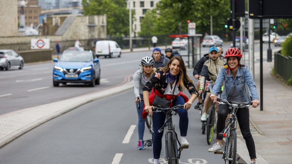

When Boris Johnson announced that three outer London boroughs would receive approximately £30 million each in funding to radically transform their town centres into ‘mini-Hollands’ few would have suspected it would lead here. While Kingston and Enfield move forward, it’s multi award-winning Waltham Forest that has made the most noise.
The original programme of using ‘modal filter cells’ to end rat-running has caused controversy and what we call ‘bikelash’. There is now an established network of international-quality cycle tracks—including the flagship Lea Bridge Road scheme, crossing the borough from the Hackney to Redbridge borders— plus major cycle parking hubs at key stations and much more.
You’ll be following in the footsteps of officials from Japan, Germany, Bogota and beyond, as well as many London and UK councillors, officers and campaigners, because Waltham Forest has established itself as a beacon of walking, cycling and Healthy Streets best practice. A true mini-Holland.
START/FINISH: Lee Valley Velo Park/Orford Road
TIME: 2 hours, including stops
TERRAIN: Mostly flat, cycle tracks and quiet streets, some busy main road crossings
GETTING THERE: By rail to Stratford (or alternative stations at Lea Bridge, Walthamstow Central, Walthamstow St James Street). Or cycle via Islington and Hackney along Quietway 2, or via River Lee/canal towpaths from Bow or Islington.

LEYTON BIKE HUB & RUCKHOLT ROAD
The Lee Valley Velo Park makes an ideal place to start a tour of Waltham Forest’s work so far. From there head up Temple Mills Lane to see an early experiment in semi-segregated measures and turn right onto Ruckholt Road. Here you can see ‘bus stop bypasses’, ‘hold the left’ traffic signals and other infrastructure designed to separate those cycling from motor vehicles. Ride all the way to the end and brave High Road Leyton to the right to see the two-storey secure cycle hub at Leyton tube station (with specific racks for cargo and family bikes).Next go back along Maud Road, Ruckholt Road and onto the old cycle tracks (mind the little kerb between track and pavement—the way Waltham Forest used to do things) on Orient Way heading north.
LEA BRIDGE ROAD
Orient Way’s old tracks take you all the way to Lea Bridge Road. To your left, and just over the brow of the railway bridge is the completed section of the new tracks on Lea Bridge Road. Ride down the tracks going west until you hit the Hackney boundary at the Princess of Wales pub, then turn east and ride the with-flow track on the north side to get the true taste of things to come. Broad 2-metre tracks with a lovely red surface and, in this section, wide pavements too.
Detour 50m left when you get back to the Orient Way junction onto Argall Way to admire the Lea Bridge station and secure cycle parking hub. Then carry on Lea Bridge Road until Hitcham Road to see tracks working their way east and the westbound tracks on the other side. Pass through old ‘modal filters’ (Hitcham, then Bridge Road, Hibbert Road, Theydon Street) to get to Markhouse Road.
Turn left along Markhouse Road to see one of the reasons Waltham Forest is winning plaudits beyond Lea Bridge Road for their main road treatments. Even where road widths are very constrained, the council is managing to make the best of a bad lot with pavements and cycle tracks. Turn off at Markhouse Avenue, then go through an old filter into Essex Road. Pass under the rail bridge and along Salop Road, Morland Road and right on Coppermill Lane briefly — route of Quietway 2, then onto Harold stone and Glenthorne Roads. At the end a dedicated cycle crossing leads into the ‘Blackhorse Village’.
BLACKHORSE VILLAGE
This was the second major ‘villagisation’ scheme. Using a new network of modal filters, this area has had all through motor traffic removed. Turn left on Pretoria Avenue until the end. Along the way you’ll see rather odd-looking modal filters built over weak rail bridges—where it was impossible for the council to dig down—and outside the school, planting beds that act as “sustainable urban drainage”. At the end of Pretoria, pause to admire the main road pedestrian/cycle crossing.
Turn back now along Pretoria and take an optional detour down Chewton Road to see the track on Blackhorse Road. These arrived just prior to mini-Holland and demonstrate the council’s level of ambition. Coming back up Chewton, go east along Northcote and then south along Palmerston Road, exiting the southern half of the Blackhorse Village to see the ‘air quality’ scheme and Quietway 2 link at Selborne Road.
SELBORNE ROAD
Arriving before mini-Holland, this air quality scheme saw bi-directional cycle tracks with a secret run along this road by the train tracks. The secret? The paving used on the tracks absorbs CO2 emissions. Ride along these tracks until Walthamstow Central. There’s a secure hub here, as well as the UK’s busiest Brompton Hire Dock.
This is where Quietway 2 is currently routed. Double back to Palmerston Road and then cut into the second half of Blackhorse Village via Mansfield Road, Erskine, then Hatherley Road. At the top of Hatherley, dogleg across Hoe Street to Milton Road and enter the ‘Hoe/Wood Village’.
HOE STREET
As you cross Hoe Street, check out the ‘Copenhagen crossings’ on the side street. At the top of Milton, turn right into Aubrey, then cross Church Hill on a parallel ‘tiger’ crossing. You’re entering the original village area. From Folkestone dogleg to West Avenue to see railway bridges again used as an ideal location for a modal filter, with extra planting and public realm. Cross Orford Road briefly and cut down Grosvenor Park Road to Hoe Street. Here you can see some early mini-Holland tracks and bus stop bypasses that have arrived before the main tracks on Hoe Street to enable a crossing to a school.
Turn left onto the track, then left on Grove Road, previously one of the worst rat-runs in the area. Ride along it past newly regenerated shops to Eden Road, then work your back via Grosvenor Rise East and Wingfield Road to the end of the pedestrianised section of Orford Road.
ORFORD ROAD
The jewel in the crown so far, this short shopping parade sees motor vehicles (bar the odd bus) banned 10am to 10pm. The result is a radically transformed space for pedestrians and cyclists, but mainly for people sitting out and chatting at cafes and on benches. Previously this was both a rat-run and anon-stop parking zone for vans.
Sit back, have a cuppa or a pint and watch Walthamstow go by—kids play in the middle of the street, cyclists ride through, people faint at the house prices in the windows. The street that appears in every TfL presentation going and that has won awards is now also set to get a rival—in the less developed Leyton mini-Holland area (also in Waltham Forest).
Francis Road may have more chicken shops than Orford Road today, but it too is getting public realm improvements and similar timed pedestrian/cycle/bus-only camera enforcement. Some are already calling it ‘Orford Road 2’.


BECOME A MEMBER AND SUPPORT OUR WORK
LCC is highly effective because it's supported by more than 10,000 members. If you cycle in London please consider joining today. You'll be supporting our work and you'll get a huge range of benefits.
MAKE A DONATION
As a charity we rely on donations from people who share our vision of making London a truly world-class cycling city. If you cycle in London, please consider making a donation today to support our work.
KEEP UP TO DATE
